Did they just add tour creation to web-based Google Earth? Yes. Yes, they did.
Google finally added the ability to generate tours with some pretty sweet features.
Google tools. Good.
Maps. Good.
Google map tools. Awesome.
The move by Google to create a web-based version of Google Earth a few years ago made sense. They needed something that would work on mobile devices and Chromebooks. But as a huge lover of the Desktop Pro version of GE, the problem for me was that the web-based version lacked so many of Pro’s bells and whistles.
I loved the ability to create tours and Google LitTrips, to use Historical Imagery, to combine different layers of data tell amazing stories. Sure. There was Tour Builder and My Maps but my heart still belonged to Google Earth.
But apparently Google listened in on enough of my conversations to do something about my need for tour creation tools in the web-based version of GE. A few weeks ago, they finally added the ability to generate tours with some pretty sweet features.
(If you’re semi-new to the Google Earth world, there are multiple versions. There’s the original Pro version that you install directly onto your laptop or desktop, there’s the more recent web-based version that runs through the Chrome browser – including on Chromebooks, and there are mobile app versions that run on tablets and phones. We’re talking about the web-based Chrome version here. While you can view tours created on the Pro and web versions on mobile versions of GE, you’re still not able to create tours on the mobile versions. Clear as mud?)
Tools and ideas to transform education. Sign up below.

These new features help you and students replicate tours already present that you can find in the Voyager section of the Chrome version. You can combine text, photos, video clips, Street View images, and 360-degree videos to immerse your viewers wherever you want to take them around the world. You can also add place marks, lines, shapes, full screen slides and the ability to add text to create rich information boxes about each of the places on your tour.
The resulting stories can be organized into narratives that will fly viewers from place to place as they watch your presentation. Get a sense of the possibilities by taking a look at a Google made tour of US national parks. Or this tour of Henry Box Brown’s escape from slavery in 1849. Maybe this Google LitTrip on Anne Frank.
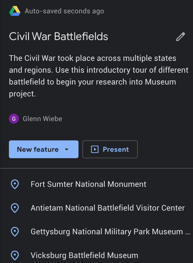
Or take a quick look at a Civil War Battlefield tour that took me about 10 minutes to throw together. Your teacher brain should be seriously jumpstarted by now. I think you can use this for a wide variety of both teacher directed and student directed projects. Geography obviously but this would also be great for integrating both fiction and non-fiction text. For connecting past events with current issues. For developing flipped classroom resources. For combining cross-disciplinary stuff like science and civic engagement projects your kids are doing in the community. For highlighting current events. Virtual field trips. Digital argumentative essays using place and movement as evidence.
One of the cool things that’s an improvement over the desktop version is the Google Drive integration. When you’re logged into GE and create a tour, your work is saved and dropped into an automatically created Drive folder titled Google Earth. The tool also works just like a collaborative Google Doc – allowing you and students to invite editors to the tour creation process. This lets you work with other teachers to build out and share tours complementing your instruction. It also means you can create and monitor work done by student groups or have students create their own tours together or individually.
This is perfect for those of you using Google Classroom. You can quickly create an assignment in Classroom and share it with students. (Though you can have kids view only or edit a tour as a class, there does seem to be the inability to create a tour and have Classroom make a separate copy for each student. Hopefully that’s on their to-do list.)
Get an easy to use five page PDF tutorial that walks you through the process step by step. Or for the YouTube lovers in the room, check out these three video walkthroughs:
So many Google Map tools. So little time.
cross posted at glennwiebe.org
Glenn Wiebe is an education and technology consultant with 15 years' experience teaching history and social studies. He is a curriculum consultant for ESSDACK, an educational service center in Hutchinson, Kansas, blogs frequently at History Tech and maintains Social Studies Central, a repository of resources targeted at K-12 educators. Visit glennwiebe.org to learn more about his speaking and presentation on education technology, innovative instruction and social studies.
